Datasheet
Start / End
Porto Moniz - Porto Moniz
Difficulty
High
Dizziness
Medium
Way
Round trip
Distance
4 Km
Duration
2h30min - 3h
Altitude Max / Min
459m / 39m
Terrain
Irregular / Sharp
Como Chegar
O ponto de partida do percurso que pretende efetuar encontra-se fixado no mapa abaixo. Por definição, o trajeto do mapa evidencia a rota a partir do centro da vila do Porto Moniz.
Para calcular o como chegar até o início da caminhada tendo por base outro local, basta inserir a sua localização, seguindo abaixo as indicações.
How to Arrive
Your starting point is defined on the map below. By default, the map always shows the route starting from the centre of the village of Porto Moniz.
To calculate how to arrive from a different starting point, simply enter the location and follow the indications below.
Как дойти
Ваша отправная точка определяется на карте ниже. По умолчанию карта всегда показывает маршрут, начиная от центра деревни Porto Moniz.
Для того чтобы рассчитать как дойти из другой отправной точки, просто переместите свое местоположение и следуйте новым указаниям.
ANFAHRT
Ihr Ausgangspunkt ist auf der unten gezeigten Karte markiert. Als Ausgangspunkt ist generell das Zentrum von Porto Moniz eingestellt.
Um eine anderen Startpunkt zu wählen, geben Sie einfach den entsprechenden Ort ein und befolgen die unten angegebene Beschreibung.
Comment y arriver
Le point de départ du parcours que vous choisissez de faire se trouve affiché dans le plan ci-dessous. En règle générale, le trajet du plan met en évidence le parcours à partir du centre de la Ville de Porto Moniz.
Pour voir comment arriver jusqu´au départ ayant pour base un autre lieu, il suffit d´introduire votre localisation, suivant les indications plus bas.
The route
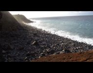
Vereda da Ladeira takes you down to the pebble stone beach of Achadas da Cruz through the path once used by local farmers. Between the abandoned fields and dilapidated cowsheds, you will find endemic plants that make this area part of the Natura 2000 network. The path, although short, is very demanding and is only recommended for experienced hikers with appropriate footwear and walking poles.
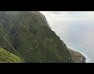
The trail begins at the viewpoint of Pombais in Santa. The path is well marked and begins with panoramic views of the Atlantic Ocean and Achadas da Cruz.
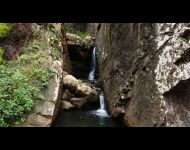
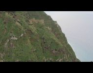
As you make your way down, any evidence of agriculture that is left fades until you are surrounded by the cliff side vegetation. Once strongly present, the abandonment of farming has given way to exotic plants that grow beside the endemic species painting the cliffs different shades of green.
Read more
GPS track
For your safety and convenience, the Municipality of Porto Moniz has provided the Global Positioning System (GPS) tracks. This way you can plan, visualise and organise in an objective manner the routes we have for you.
Make sure that you are physically able to do your desired walk and test the GPS file before going.


